Again, it had been too long since I'd spent some quality time with nature so R and I headed out to Placerita Canyon to explore. Placerita Canyon is close enough to LA to get to in a reasonable amount of time (this day it took us about 45-min) but it's remote enough to feel like you're away from the city and it has a Nature Center at the start with information, restrooms, free parking, etc. I'd been there with V and others for a mycology lecture back in March 2010 (how time flies!) and had always wanted to return.
Here's where we started:
The park publishes a map along with descriptions of the trails at their website. We had the option to take a 4-mile or 7-mile hike and we opted for the 7-miler even though it was pretty warm out. The trail description said to allow at least 5 hours for the hike. This was our planned hike:

The lower portions of Canyon Trail are relatively easy to hike. There were some wildflowers
 |
| Orange Bush Monkeyflower (Mimulus aurantiacus) |
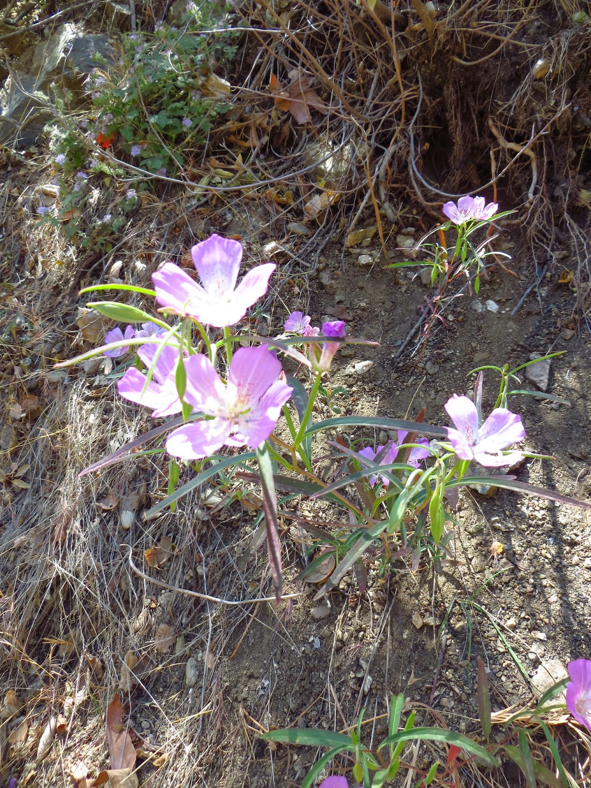 |
| Genus Clarkia, Evening Primrose Family |

 |
| White oil |

 |
| Steller's Jay (Cyanocitta stelleri) |
 |
| Indian-pink (Silene laciniata) |
 |
| Purple Chinese Houses (Collinsia heterophylla) |


We just kept walking on the road until we came to a fork a mile or so along and took the right trail which we realized immediately was not maintained. We finally pulled out a smartphone to see where we were and it turns out we had walked quite a ways west on Whitney Canyon Road. We tried to figure out how we could get back without retracing our steps, but it soon became apparent that we'd have to turn around and try to find that Firebreak Road.
Using GPS we were able to find it but it was completely unmarked. Funny thing is, when we were in that area on our first go around we had even taken a photo right at that spot (below) and R had walked over to the trail to see if was ours, but seeing our trail was called Firebreak I expected it to be a Fire Road and this trail was skinny (not large enough for a vehicle). Learned my lesson that Firebreaks and Fire Roads are not the same thing!

Anyway, the Firebreak Ridge turned out to have gorgeous views, but it was full sun (again!) and pretty steep up and down.

Needless to say, we were happy when we came to the Manzanita Trail which took us back down to the Main Trailhead.
Later we calculated how much our "detour" added to the hike and we'd added 4 miles making this an 11-mile hike - the longest I'd ever done. And we did it in 5 hours!
Great day outside. Great to get to know R a bit better. TEAM GIRL TRIP!
You can see more of my photos from this location in the album.
Comments
Post a Comment